Is the Peace, Tranquillity and Beauty of Shoebury Common under Threat from the Council's Proposals? |
||
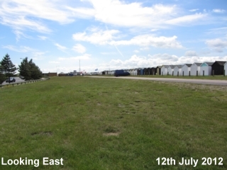
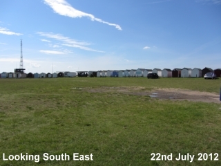
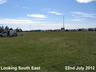
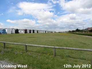
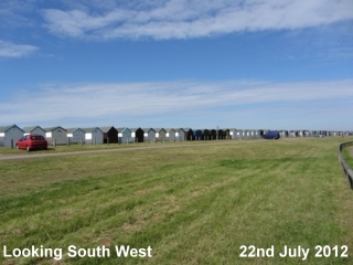
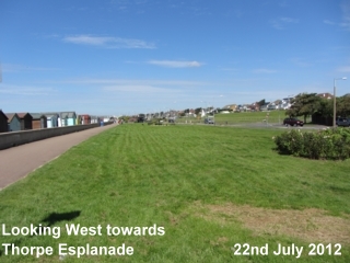
The RiskTo look objectively at the situation one must consider the degree of risk of flooding. Environment Agency updateThe Environment Agency Web site appears to have been recently updated and now, in 2014, the risk of flooding from rivers and sea in the area around Shoebury Common Road, Ness Road and both Old and New Gunners' Park has been increased from "Low" to "High"; the area is classified as a Level 3 Flood Zone. Surely it is better to work with nature than try to fight against her. It would be wise to make full use of the natural flood plain that is the broad expanse of both Shoebury Commons South and North instead of blocking it off. Much of any excess flood water would then continue to be absorbed into that flood plain, as has undoubtedly happened over the centuries. Certainly, any plan to build houses on Old Gunners' Park, a level 3 floodplain, should be totally dismissed, as indeed any concept of building on the car park of Shoebury Common North. This, particularly, as maintaining the seawall along the Garrison Frontage is already proving a costly and very much ongoing affair. The Environment Agency maps show the "Risk of Flooding from Rivers and Sea". The maps do not cover the risk of tidal flooding alone, they covers the risk of flooding from rivers overflowing due to heavy rainfall as well. It would be interesting to know how much of the threat of flooding here comes from rivers and how much from the sea. The risk of flooding on and around Shoebury Common comes not only from the River Thames to the south, but from the stream or creek sometimes called The River Shoe. The Council's proposal for new sea defences will not eliminate the risk of flooding from heavy rainfall causing the River Shoe to overflow. The Shoe carries surface water away from the fields behind the Angel Roundabout, North Shoebury, behind shops on the east side of Ness Road, under Campfield Road, into Gunners' Park and empties into the sea near New Barge Pier. This has in the past overflowed, not from high tides but, from heavy rainfall, and, on 15th September 1968, I recall it brought flooding to houses along Ness Road. On that same occasion, nearly 400 homes in Southend similarly suffered water damage when Prittle Brook and the stream alongside Willingale Way, Thorpe Bay, overflowed. More recently, on 24th August 2013, heavy rain brought more flooding to Southend and Shoeburyness. Once more, The Shoe overflowed its banks as can be seen by clicking on the image below:
The flooding was not caused by high tides overtopping but by heavy rainfall. No doubt the situation along Campfield Road was exacerbated by the dumping of soil last year in the area where previously excess rainwater used to drain away. As well as the bungalow photographed, in very close proximity to the flooded road is the Ambulance Station, the Doctors' Surgery, the Pharmacy and the Telephone Exchange. Although Shoebury Common Road was also flooded by the rainwater, it remained passable. However, building the embankment on Shoebury Common would no doubt prevent water from draining away on Shoebury Common and make Shoebury Common Road impassable too. Similar flooding occurred here just 7 weeks later:
At the beginning of December 2013, work begun on clearing the ditches in Old Gunners' Park and was due to finish before Christmas. The ditches were certainly cleared but it is interesting to see water still laying on surrounding areas, making footpathes impassable. The area is boggy, marshy and seems to be returning to a wetland area. After all, in a 17th century map, various creeks are shown dividing the area into, "The Great Marsh", "Home Marsh" and "Slee Marsh".
It is interesting to note that a detailed survey of the area was conducted in 2010 by Scott Wilson, Design and Engineering Consultants, now The URS Corporation. There is a report on the Southend Borough Council Web site. It gives clear details of the flooding risks that would affect future development here, with much information on the risk of groundwater flooding. It states: the low elevations and flat topography of the Shoeburyness area is conductive to surface water ponding. It goes on to describe that: ponding of water adjacent to the drainage ditch know as the River Shoe as well as other locations in Shoeburyness is thought to be linked to high groundwater levels. An illustration of "ponding" in Gunners' Park can be seen in the following photograph, taken in 2001:
The New Hinguar School stands in this area now. The Environment Agency MapsThere are various maps on the Environment Agency's Web site which show the risk of flooding from various sources. Go to: http://www.environment-agency.gov.uk/homeandleisure/37793.aspxIn the box on the right hand side headed, "Flood Maps, are you at risk of flooding?", enter a Shoeburyness postcode beginning with SS3.You can move the map around to centre on Shoebury Common. If you click on any area of the map, the risk factor will appear. Prior to the recent update, I was not been able to find any area around Shoebury Common and Ness Road with a risk higher than, "Low". The Environment Agency described the classification of "Low" as: "The location you have selected is in an area that is unlikely to flood except in extreme conditions. The chance of flooding each year is 0.5% (1 in 200) or less. This takes into account the effect of any flood defences that may be in this area, whether or not these are currently illustrated on the Flood Map." Note that the area around Southchurch Park, where there are very many more houses that would be affected, is similarly described. In 2013 it was classified, like Shoebury Common, as "Low". Move further towards Southend and the area near Pier Hill, was described as, "Significant". The Environment Agency described the classification of "Significant" as: The location you have selected is in an area that has a significant chance of flooding. The chance of flooding each year is greater than 1.3% (1 in 75). This takes into account the effect of any flood defences that may be in this area, whether or not these are currently illustrated on the Flood Map. Additionally, returning to the Shoeburyness area and centring around East Beach and areas northwards towards Wakering, the risk here was described, as "Significant". Flooding from the sea in this area would be caused by the sea coming in from the east, directly from the North Sea. New sea defences on Shoebury Common would not prevent flooding at East Beach nor at any points northwards from East Beach.
|